

Hurricane Priscilla will become a more powerful storm this week as it continues to strengthen over the Pacific Ocean off southwest Mexico. The National Hurricane Center, which is based in Miami, said the storm was expected to bring heavy rains and gusty winds to the region.
The Mexican government issued a tropical storm watch for Baja California Sur on Monday morning, stretching from Cabo San Lucas to Santa Fe. Another tropical storm watch was in effect from Punta San Telmo to Punta Mita, Mexico.
Hurricane Priscilla’s track and forecast
On its forecast track, Priscilla’s center “is expected to move offshore of and parallel to the coast of southwestern Mexico and Baja California Sur through the early-to-middle part of this week,” the hurricane center said in an advisory.
“Additional strengthening is forecast, and Priscilla is expected to become a category 2 hurricane, and could approach major hurricane status within the next couple of days,” it added. Priscilla will likely start weakening by midweek.
Category 2 hurricanes have sustained winds of at least 96 mph. Major hurricane categories begin at 3, with minimum sustained winds of 111 mph.
Nikki Nolan/CBS News 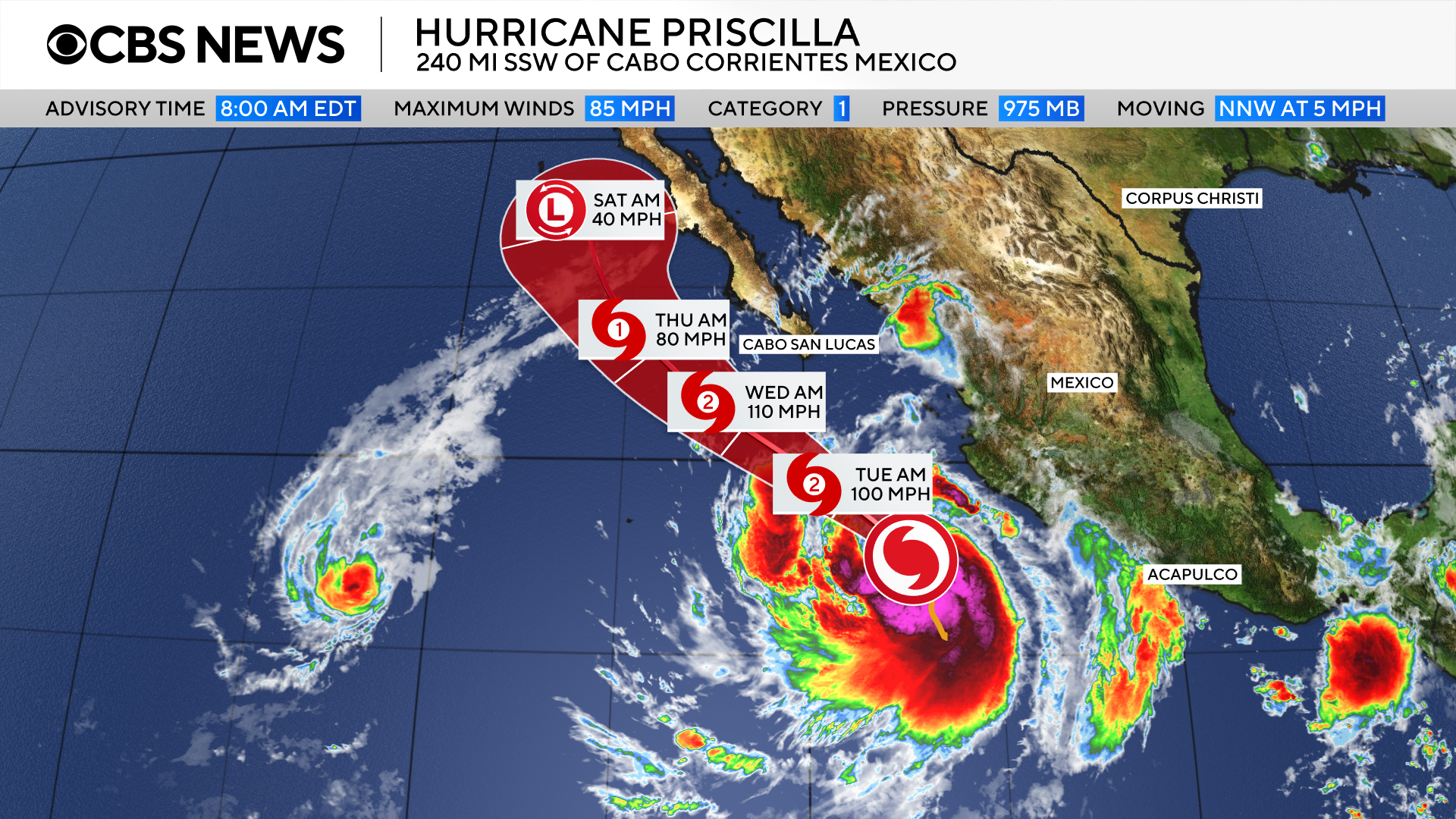
As of the NHC’s 2 p.m. EDT update on Monday, the storm was located about 205 miles south-southwest of Cabo Corrientes, near the resort town of Puerto Vallarta, and about 370 miles south-southeast of the southern tip of Baja California.
It was traveling north-northwest at 6 mph with maximum sustained winds of 85 mph.
NOAA/National Hurricane Center 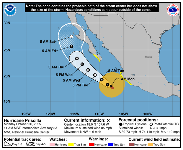
Although Priscilla is forecast to remain several hundred miles from the Mexican coast, heavy rain, tropical storm-force winds and swells are possible in places that the storm is due to pass on its path, said CBS News meteorologist Nikki Nolan.
NOAA / National Hurricane Center 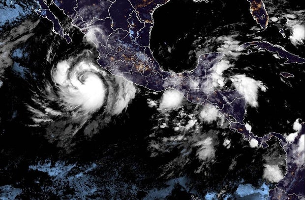
“Outer bands from Priscilla will continue to bring heavy rain to portions of southwestern Mexico today,” the hurricane center said, with 2-4 inches expected and up to 6 inches in some spots, enough to “bring a risk of flash flooding, especially in areas of higher terrain.”
Swells generated by Priscilla have started affecting parts of the southwestern Mexico coast and will get to portions of the west-central Mexican coast and southern Baja California Peninsula today, the center cautioned, and the swells “are likely to cause life-threatening surf and rip current conditions.”

